What are weather instruments?
Weather instruments, are specialized equipment used in weather forecasting, weather monitoring and other meteorological service areas. It can be categorized into two categories: ground weather observation instruments and high-altitude weather detection instruments.
What are the 12 weather instruments and their uses?
1. Thermometer
Temperature is the most basic data for weather studies, and thermometers are an integral part of weather instruments. It is used to measure and collect temperature data of the current area. With the advancement of technology, thermometers used in weather research are no longer limited to liquid thermometers using alcohol or mercury as the medium. Resistance thermometers, thermocouple thermometers and semiconductor thermometers are all reliable instruments. That is why modern weather stations use platinum resistance thermometers (RTDs) and semiconductor thermometers, while liquid thermometers are mostly used in traditional weather stations.
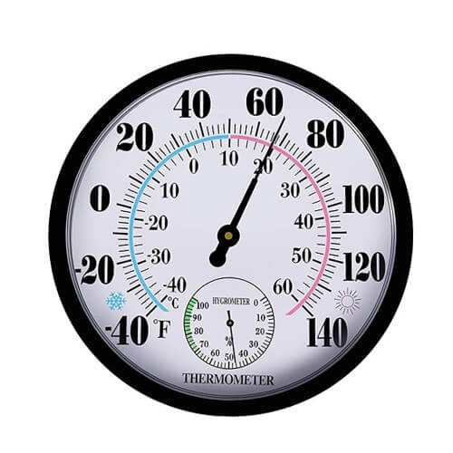
By choosing the best thermometer, the more accurate the temperature data obtained, the more accurate the analysis of the weather will be. These data can be used for environmental protection, agrometeorology, climate research and aviation and navigation.
Atmospheric pressure is closely related to wind direction, storms and other weather phenomena. Barometers are used to measure the atmospheric pressure of the environment. Similar to the mercury thermometer, the traditional barometer uses mercury as the medium (the principle is to measure atmospheric pressure by utilizing the dynamic equilibrium of mercury under gravity). Another type of liquidless barometer utilizes the degree of deformation of a vacuum metal box to measure atmospheric pressure. Electronic barometers (Digital Barometer) are now used in weather stations. This is because it has more obvious advantages and more accurate data.
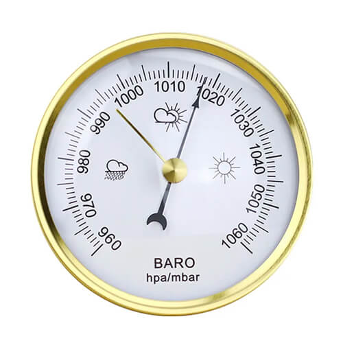
Barometric data is mostly used in weather forecasting, outdoor hiking, aviation and navigation.
3. Hygrometer
Another meteorological factor that is often mentioned together with temperature is humidity. Changes in the humidity of the air are measured by a hygrometer. In the past, the hygrometer was made by utilizing the hygroscopicity of human or animal hair, and the length of the hair would change with the humidity. The change in hair length is then amplified by a mechanical device and indicated on a dial. Other hygrometers utilize the resistance of hygroscopic materials to change with humidity.
In addition to their use in agricultural smart irrigation and weather monitoring, hygrometers are effective in preventing mold growth when used in logistics, transportation, and storage processes.
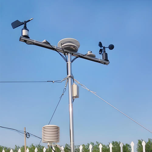
4. Anemometer
All weather monitoring systems have anemometers, which are indispensable weather instruments. Different types of anemometers are suitable for different application scenarios. Choosing the right anemometer and using it in the right way can help to obtain accurate and reliable wind speed data. Among them, the ultrasonic and three-cup anemometer is mostly used in weather systems or home weather monitoring.
Anemometers can be used to predict weather changes, ensure flight and navigation safety, assess the spread of air pollution, optimize the design of wind power generation and ensure the safety of outdoor activities.
5. Wind vane
A traditional wind vane usually consists of an indicator (such as an arrow or animal shape) and a vertical axis. The vertical axis rotates due to the wind in the environment and then the arrow points in the direction the wind is blowing. As people demand more and more accuracy, the electronic wind vane was created. It utilizes electronic sensors and rotary encoders to detect the direction and convert it into an electrical signal to provide accurate wind direction data. In the vast majority of cases wind vanes are used in conjunction with anemometers to provide a comprehensive representation of wind properties.
Wind vanes are used for meteorological research, ships and harbors, pesticide spraying in agriculture, air pollutant dispersion direction, building design and wind power generation.
6. Rain gauge
A rain gauge is a device that measures the amount of rainfall in an area and supports viewing rainfall information by date and time period. A simple rain gauge consists of a funnel and a collection container that collects rainwater that needs to be read manually. A tipping bucket rain gauge is a more complex device but is capable of automatically recording rainfall data.
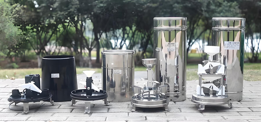
Uses of rain gauges include issuing flood warnings in environmental monitoring, rationalizing irrigation arrangements in agricultural production, and helping to design drainage systems to prevent urban flooding in urban planning.
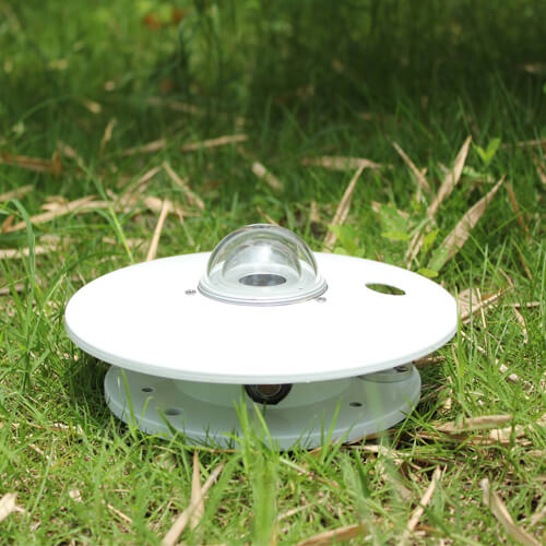
7. Sunshine recorder
The monitoring of the sun in meteorology is mainly focused on light and radiation. A sunshine recorder is an instrument designed to measure the intensity and duration of light. In the past, the Campbell-Stokes Sunshine Recorder, consisting of a glass sphere and a paper strip recorder, was widely used. It reflected the intensity and duration of light based on the marks and length of the paper strips burned. And nowadays, digital light recorders using the photodiode principle are widely used on automatic weather stations. It can sense the light intensity and turn it into a weak electrical signal, and finally output an electrical signal.
In the field of meteorology, sunlight recorders help to predict climate change by monitoring sunlight hours. In the field of agriculture, the light logger can realize the monitoring of light intensity of the farmland, help farmers to understand the light condition of the farmland, and reasonably arrange the planting and harvesting time of crops.
8. Radiometer
Unlike a sunshine recorder, the radiometer is one of the weather instruments that measure the intensity of solar radiation. There are many types of radiometers, and the range of measurement can cover from ultraviolet to infrared. Currently, the photoelectric radiometer and thermoelectric radiometer is commonly used. Both are commonly used radiometers in weather monitoring systems. Thermoelectric radiometers are more accurate and correspondingly more expensive.
Radiometers can be used to monitor the solar radiation balance and the greenhouse effect, to measure the radiation from celestial bodies in astronomy, to study the origin and evolution of the universe, and to assess the radiation effects of pollutants in environmental science.
9. Ceilometer
A cloud altimeter is a weather instrument that measures the height and thickness of clouds. The principle of operation is based on either laser pulses or photodetectors. Both methods are suitable for measuring low cloud cover data.
Ceilometers are mainly used in the fields of meteorological change, aviation safety and environmental monitoring. Through accurate cloud height measurements, cloud gauges can improve weather forecasting, enhance flight safety, and deepen the understanding of climate change and environmental conditions.
10. Radar
Radar is a radio wave detection technology that is an active microwave atmospheric remote sensing device. Weather radars use a wide range of radio wavelengths, from 1 centimeter to 1,000 centimeters. They are often divided into different bands to indicate the primary function of the radar. Any radar that does not have Doppler performance is called a non-coherent or conventional weather radar, and a radar with Doppler performance is called a coherent or Doppler radar. Weather radars can detect the height and thickness of clouds that have not formed precipitation, as well as the physical properties within the clouds, so as to analyze the distribution, movement and evolution of precipitation.
The radar is capable of providing the pilot with continuous in-flight weather conditions ahead and to either side of the flight path, in addition to providing a map-type display of surface features ahead of the aircraft. This allows the pilot to select a safe course, avoid dangerous weather areas or other obstacles, identify landmarks, and determine the position of the aircraft.
11. Lidar
Lidar is an active remote sensing device that uses a laser as the emitting light source and optoelectronic detection technology. Lidar is an advanced detection method combining laser technology and modern photoelectric detection technology. Lidar’s working principle is very similar to radar, pulsed laser constantly scanning the target object, you can get the target object on all the target point data, with this data for imaging processing, you can get accurate three-dimensional stereo image.
LIDAR is widely used in the fields of terrain mapping, environmental monitoring, autonomous driving, archaeology and urban planning.
12. Weather satellite
Weather satellites are a kind of equipment specialized in monitoring and collecting data on the Earth’s atmosphere and surface. Various meteorological remote sensors carried by satellites receive and measure visible light, infrared and microwave radiation from the Earth and its atmosphere, as well as electromagnetic waves reflected by satellite navigation systems, and convert them into electrical signals for transmission to ground stations. The ground stations recover the electrical signals from the satellites and map them into various cloud cover and wind speed and direction.
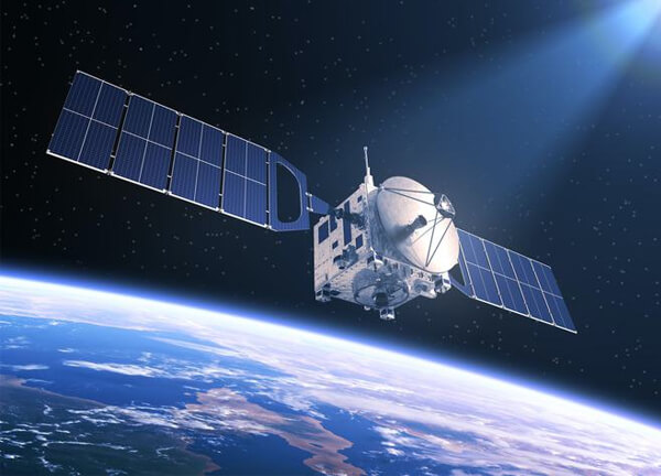
Weather satellites provide real-time data on cloud cover, precipitation, wind speed and temperature to help prevent extreme weather such as hurricanes, typhoons and thunderstorms. Weather satellites can monitor natural disasters such as volcanic activity, forest fires, and floods, as well as monitor various types of environmental pollution. Weather satellites provide soil and vegetation data to provide scientific management programs.
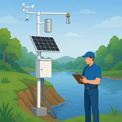
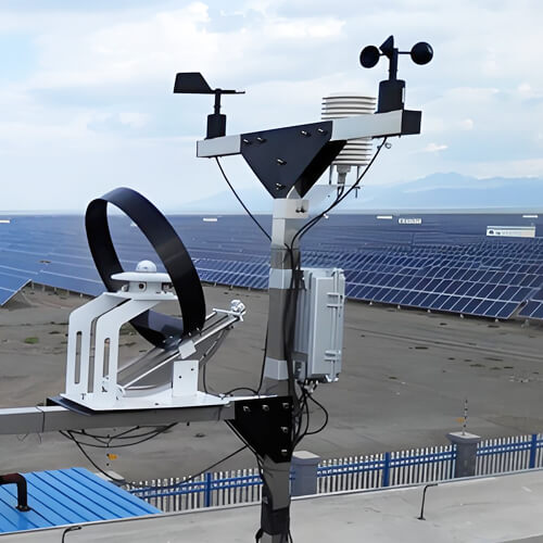
What is the relationship between weather instruments and weather stations?
Weather instruments are devices that measure and record different atmospheric parameters one by one. These weather instruments can be used individually or combined to form part of a weather station. A weather station is an integrated system that incorporates a variety of weather instruments to enable the comprehensive recording of multiple meteorological parameters. Weather instruments are the basic components of a weather station, and the two are interdependent, together providing accurate data to support weather monitoring and forecasting.
What are the uses of weather instruments?
Weather forecasting
Monitoring devices such as hygrometers, barometers, anemometers, etc. can provide real-time data that can be analyzed and researched scientifically by the control platform to predict weather changes in the next few hours or days. In addition, long-term data monitoring can predict weather changes, such as El Niño or global warming phenomenon.
Disaster warning
Weather instruments can monitor extreme weather changes in real time, such as flood warnings issued by water level monitoring stations when they detect abnormal water levels, and extreme weather such as typhoons and hurricanes detected by weather satellite systems. Through weather instruments to take timely measures to respond to disasters. Minimize personal and property losses.
Environmental monitoring
The use of anemometers to monitor the flow rate and flow direction of pollutants in the air, such as: sulfur dioxide, PM2.5, ozone and so on. Help the environmental protection department to deal with pollutants rationally and effectively.
Agricultural management
Agricultural installation of weather instruments can provide real-time temperature, rainfall, light, soil conditions and other data, the control platform to scientifically analyze the data, providing farmers with the best planting crops and scientific irrigation methods and other recommendations. It can effectively improve the health and yield of crops.
Aviation and navigation
Meteorological monitoring is the most important guarantee for the safety of navigation and aviation. Aircraft flights and ships need weather satellite navigation and provide real-time data. It helps them to avoid bad weather.
Urban planning
When planning and designing a city, the data collected by weather instruments make it easy to choose the right place to live. Avoid natural disaster-prone locations. Meanwhile, transportation hubs are scientifically planned.